Tag Archive for: Irrigation

By Stephanie Kasper, University of Texas Rio GraSoil for Waternde Valley Program Manager

As a south Texas farmer, there’s not much I love more than a refreshing rainy day. However, my rain appreciation grew deeper this year after my partner John and I installed a 1,650-gallon rain harvest system at our house.

After moving into our home just outside Edinburg city limits in February 2022, we replaced most of our turf grass with a 336-square-foot vegetable garden in the front yard and an 840-square- foot one in the back, surrounded by vibrant native wildflowers.

The transformation from a lawn to food-producing gardens brought us both joy and water savings. Drought-adapted native plants require less water than traditional grass lawns, and we use drip irrigation for the vegetables, which is more efficient than overhead sprinklers. However, we wanted to reduce our reliance on the municipal water supply for outdoor plants even further, and help save the cleanest, highest-quality water for human consumption.

This desire felt ever more pressing as we settled into another hot, dry south Texas summer. Falcon Reservoir, which supplies water to the Rio Grande Valley, reached a historic low of 9% capacity in August 2022, leading to water use restrictions. Frustrated by complex water management issues and worried about our region’s long-term water supplies, I channeled that energy into action at home. I mapped my roof’s runoff potential and natural drip points, gathered supplies from Lowes, found six food-grade, 275-gallon IBC totes on Facebook Marketplace (with free delivery!), and studied YouTube videos on gutter installations.

The first rainfall after installing the gutters and tanks had me running from tank to tank, blissfully soaked, watching the water pour in. Even after nearly a year, I’m still out there for nearly every rainfall, happily watching the tanks fill and clearing any debris blocking the water flow.

A rain harvester rule of thumb is that 1 inch of rain on 1 square foot yields 0.6 gallons of potential water capture. With a roof area of 2,000 square feet and an average of 23 inches of rain in Edinburg per year, over 27,000 gallons of water flow off my roof annually. My 1,650-gallon tank storage can be filled entirely with just 1.5 inches of rain.

I arranged the tanks based on the flow rates of each roof section and with the destinations for water use in mind – two tanks in the front yard for the smaller front garden and four in the back for the larger backyard garden. The two front yard tanks are located at natural drip points, where 438 square feet of roof runoff can be channeled into them without additional gutter installations. These natural drip points are the easiest entry point for rain harvesting.

Once the rainwater is collected, the key is to use it efficiently. We use a 12V plug-in water pump to send water directly into the existing garden drip irrigation systems, eliminating the need for manual water hauling. The front yard drip irrigation uses 1.3 gallons per minute, so the 550 gallons of stored rainwater can provide about seven hours of irrigation time. The backyard system, with a water use rate of 2 gallons per minute and 1,100 gallons of water storage, provides nine hours of irrigation time.

In the past year, the stored water has helped reduce our municipal water use even further. The front yard garden required supplemental city water for only 50 out of 365 days (14%), and the back yard needed it for 153 out of 365 days (42%), with the gardens collectively producing 148 pounds of food in that time. Our city water usage came mostly during a 97-day dry stretch between late December and late March, when we received a total of only 0.5 inches of scattered rainfall. Since the backyard system was not complete until midway through last year, I expect our city water needs to decrease even further next year. The system is modular, and we can add additional tanks to increase water storage capacity based on our needs, providing flexibility for the future.

Installing a rain harvest system takes planning, funds, and maintenance, and I’m not going to suggest that it’s an easy sustainability swap that’s right for everyone. I’ve only saved a few dollars each month on my water bill at most. However, it has given me confidence in the resilience of our food-producing gardens amid heat waves and droughts and made me a more conscious water user.

Rainwater harvesting is already supported in Texas through exemptions from state sales tax on equipment and supplies. Some cities, like San Antonio and Austin, also offer educational programming and rainwater storage rebate programs to encourage rain harvesting. However, more efforts are required to promote rainwater harvesting on a larger scale, especially as Texas stares down the impacts of climate change and prepares for significant potential water shortfalls by 2040. Confronting these challenges in the Rio Grande Valley and beyond must include a reconsideration of our relationship with water, in small ways and large, to secure a sustainable future for all.

Related NCAT Resources:

Topic Area: Drought

Drought and Disaster Resources for Texas Producers

The Texas Irrigator’s Pocket Guide

Managing Soils for Water: How Five Principles of Soil Health Support Water Infiltration and Storage

Soil Moisture Monitoring: Low-Cost Tools and Methods

Other Resources:

Agroecology and Resilient Food Systems, University of Texas Rio Grande Valley


Responding to water shortages and uncertainties throughout the western United States, the National Center for Appropriate Technology (NCAT) has released a new edition of its popular The Irrigator’s Pocket Guide.

“With growing conflict over water supplies, and with irrigators feeling the pinch to save water, energy, and money, we wanted to come up with a concise and super-useful guide to water and energy conservation,” said Mike Morris, NCAT’s Southwest Regional Director, who headed up the project.

Irrigation experts from more than 20 states have weighed in on The Irrigator’s Pocket Guide over the years, and more than 30,000 copies have been distributed.

This new edition was developed through NCAT’s Soil for Water project, with funding from USDA’s Natural Resources Conservation Service (NRCS).

“In this new edition of The Irrigator’s Pocket Guide, we decided to go beyond pump and motor maintenance and irrigation scheduling and incorporate recent advances in soil science,” Morris said. “When soil gets healthier, it catches and holds more water. Taking care of soil health therefore needs to be a priority for all irrigators.”

The Equipment Maintenance half of the book features clear and detailed maintenance and troubleshooting procedures for pumps, motors, engines, control panels, and distribution systems. The Water Maintenance section of the book covers soil health and gives step-by-step instructions for running all common types of irrigation systems efficiently — matching water applied to crop needs.

The compact 150-page book includes dozens of diagrams, tables, and handy conversions and formulas for calculating things like flow rates, area, pressure, power, friction losses, and how long to run a system to apply a given volume of water. With its small 4-inch by 6-inch size and durable waterproof covers, the book is a friendly companion to carry in your hip pocket or the glove box of your truck.

Free copies are available by mail or online at the ATTRA website.

Along with the updated edition of the original The Irrigator’s Pocket Guide, new state-specific editions are also available for irrigators in Colorado, New Mexico, and Texas, as well as an updated version of the popular The California Microirrigation Pocket Guide. All these books can be found on the ATTRA website.

By Mike Morris, Director of NCAT’s Southwest Regional Office

In my work on NCAT’s Soil for Water Project, I’ve tried a lot of different ways of monitoring land and soil health. For years, I’ve been hearing about LandPKS (Land Potential Knowledge System), a mobile app that has been under development by the USDA Agricultural Research Service (ARS) since 2013. I was excited to hear that a full version was released earlier this year, and a couple weeks ago I finally got around to installing the app on my phone and running it through some tests.

The purpose of LandPKS is to help you “discover the potential of your land and monitor change over time.” Several things about the app appealed to me right off the bat. It’s built to meet the practical needs of farmers, ranchers, and land managers, helping you learn what’s realistically possible on your land. Equally useful on cropland, rangeland, or pastures, the app takes a lot of the pain and drudgery out of soil and vegetation monitoring. Data collected in the field is stored on your phone and uploaded to the cloud as soon as you have cellular or wireless access. No more clipboards or paper blowing away in the wind.

LandPKS is built around standard indicators of land health that have been used by the USDA Natural Resources Service (NRCS) since 2003. The developers want the app to become a standard tool, in the hopes that more standardized data collection will (over time) allow us to see patterns that improve our understanding of soils and land. LandPKS is an open-source product that allows others to develop additional software products to complement what it does. It will surely get better over time.

The app is sophisticated and powerful, with too many features to describe here. A key point is that it takes advantage of staggering amounts of free geospatial data. This includes nearly-nationwide soil information from the NRCS. As soon you install the app, you’ll see that a lot of information about your climate, vegetation, and soils has been entered automatically. Other values, such as infiltration rates and plant-available water-holding capacity, are calculated or predicted without you lifting a finger. You can quickly pull up maps of your location.

LandPKS encourages data sharing. You can easily compare your results and site descriptions with ones that others have recorded. (There’s a privacy option, however, if you don’t want your information to appear on the public website.)

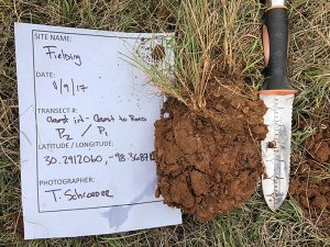
As a new user of the app, I appreciated the abundant instructions and guides, such as a soil color chart, a guide to determining soil texture, and a slope-estimating tool. There are handy calendars for recording field management activities (such as irrigation, plantings, tillage, fertilizer, pests, harvest, residue management, and erosion control), as well as places to record soil test results and observations about soil erosion, compaction, aggregate stability, smell, or biological activity. You can also take photos of the landscape, soil pits, or plants you want to identify later.

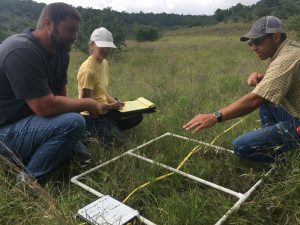
Designed to accommodate users in developing countries, LandPKS makes heavy use of dropdown menus and clickable images, reducing the need for typing. Relying on pictures more than words is one of the app’s strengths. For example, you monitor land cover by dropping a stick on the ground (such as a yardstick), and simply clicking icons that match what you see touching various points along the stick: trees, shrubs, perennial forbs, plant bases, perennial grasses, annual plants, herbaceous litter, woody litter, rock fragments, or bare ground. The developers claim that land cover monitoring can be done in as little as 20 minutes per location, and I can easily believe this.

Potential drawbacks? Well, some (although I suspect not many) will want more detailed or precise measurements than what LandPKS offers, or a wider range of soil health indicators. Others may find LandPKS (despite all its user-friendly features) to be more complicated than they like or need. You can’t please everyone.

The key to all land monitoring is persistence. Any soil-monitoring tool or method has to strike a balance: collecting enough information to be meaningful while keeping things simple enough to be done consistently over a period of years.

LandPKS checks a lot of boxes for me, and certainly makes land monitoring less intimidating. It will be interesting to see if the tool catches on and becomes widely used by farmers, ranchers, and land managers.

You can download LandPKS from the App Store or Google Play Store or learn more about it at landpotential.org, where you’ll also find a Knowledge Hub full of user guides, publications, and case studies. If you try the app, I’d love to hear what you think of it.

For more information, contact Mike Morris directly at mikem@ncat.org.