By Mike Morris, NCAT Southwest Regional Office Director
A few months ago, I was given the enjoyable assignment of updating the 2006 ATTRA publication Soil Moisture Monitoring: Low-Cost Tools and Methods. I was curious to learn what had changed in the world of soil moisture monitoring and irrigation scheduling over the past decade or so.
Now, as always, you can do a pretty good job of checking your soil moisture with a shovel, the “feel and appearance” method (no cost), a hand push probe ($30-$70), or tensiometers ($50-$150 apiece). But if you’ve got anywhere from a few hundred to a few thousand dollars to spend, I learned that there are some interesting new options to consider.
Browsing around the Internet, I learned that data logger setups have evolved and are now available in many wireless configurations. A data logger is a device, usually powered by batteries or a solar panel, that records data at intervals ranging from every few minutes to every few hours. Data loggers can be hooked up by cables to buried soil moisture sensors, automatically recording your soil moisture and storing months or years of data that can be downloaded at your convenience or sent directly via the Internet to your phone or laptop, in real time.
Most surprising of all was what I learned about satellite imagery. In 2006, using satellite imagery to estimate evapotranspiration (ET)—the combined effect of evaporation and transpiration—did not exist in any meaningful way. The closest thing we had was publicly-available weather station networks like the Bureau of Reclamation’s AgriMet network for the Pacific Northwest and the California Irrigation Management Information System (CIMIS). These networks provide estimates of current and historical ET, although they have some real limitations, not least of which is the fact that the nearest weather station may be dozens or even hundreds of miles from your location.
Today, satellites are rapidly entering the mainstream. Among other advantages, satellite images can show soil moisture conditions over an entire field or farm. For a few years now, companies like IrriWatch have been providing satellite-based irrigation recommendations for an annual subscription cost of several dollars per acre. Then, in 2021, OpenET burst onto the scene.
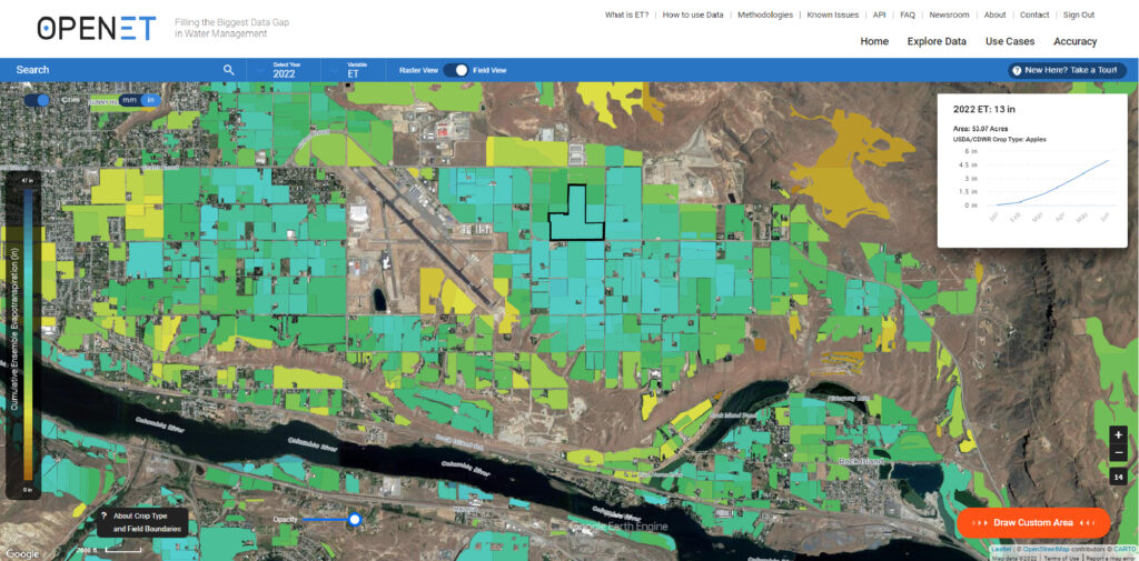
Screenshot from the OpenET website.
Developed by NASA, the Environmental Defense Fund, the U.S. Geological Service, the USDA Agricultural Research Service, and other partners, OpenET uses NASA satellite data (including things like leaf temperature, leaf size, and solar radiation) along with meteorological, soil, and vegetation datasets, to provide readily available satellite-based ET estimates for the entire western United States. You see a map, in familiar Google Earth layout, and can zoom all the way down to field scale, reading ET estimates for millions of individual fields or at the quarter-acre resolution of satellite data. You can also draw shapes on the map and see monthly and annual ET values within those boundaries.
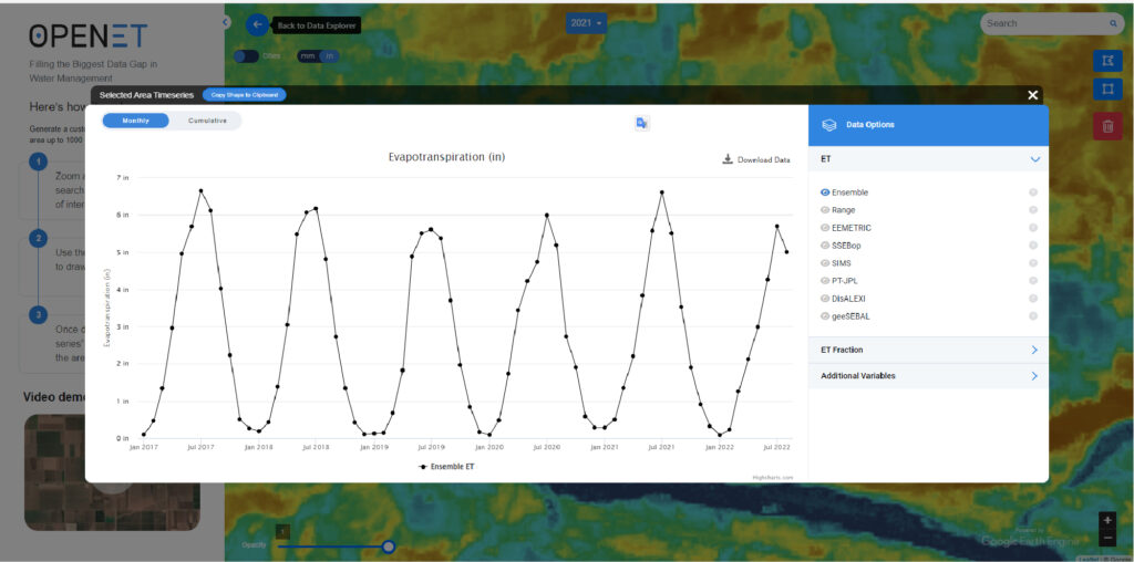
Screenshot from the OpenET website.
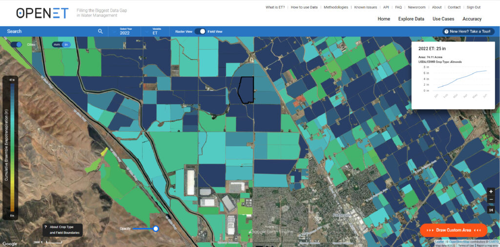
Screenshot from the OpenET website.
The maps are stunning, and you owe it to yourself to check it out. I found the site extremely user-friendly. It took me only about 15 minutes to set up a password and start zooming around the maps and looking at ET levels in almond orchards, wheat fields, and pastures around the country. Best of all, everything in the OpenET Data Explorer is free to view. A goal of the project is to keep the data free and easily available, although some users who need large-scale access will eventually need to pay.
To learn more about affordable soil moisture monitoring options, download the free, newly updated ATTRA publication Soil Moisture Monitoring: Low-Cost Tools and Methods. And if you try OpenET, post a comment at the Soil for Water Forum and tell us how you liked it.
Related ATTRA Resources